The EU-wide systems for mapping farm fields eligible for subsidy are helping to cut the number of errors in payments to farmers, but there is still room for further improvement, according to a new report.
The auditors examined whether the Land Parcel Identification Systems (LPISs) were well managed by EU nations.
They visited Austria, Germany, Ireland, Poland and the United Kingdom.
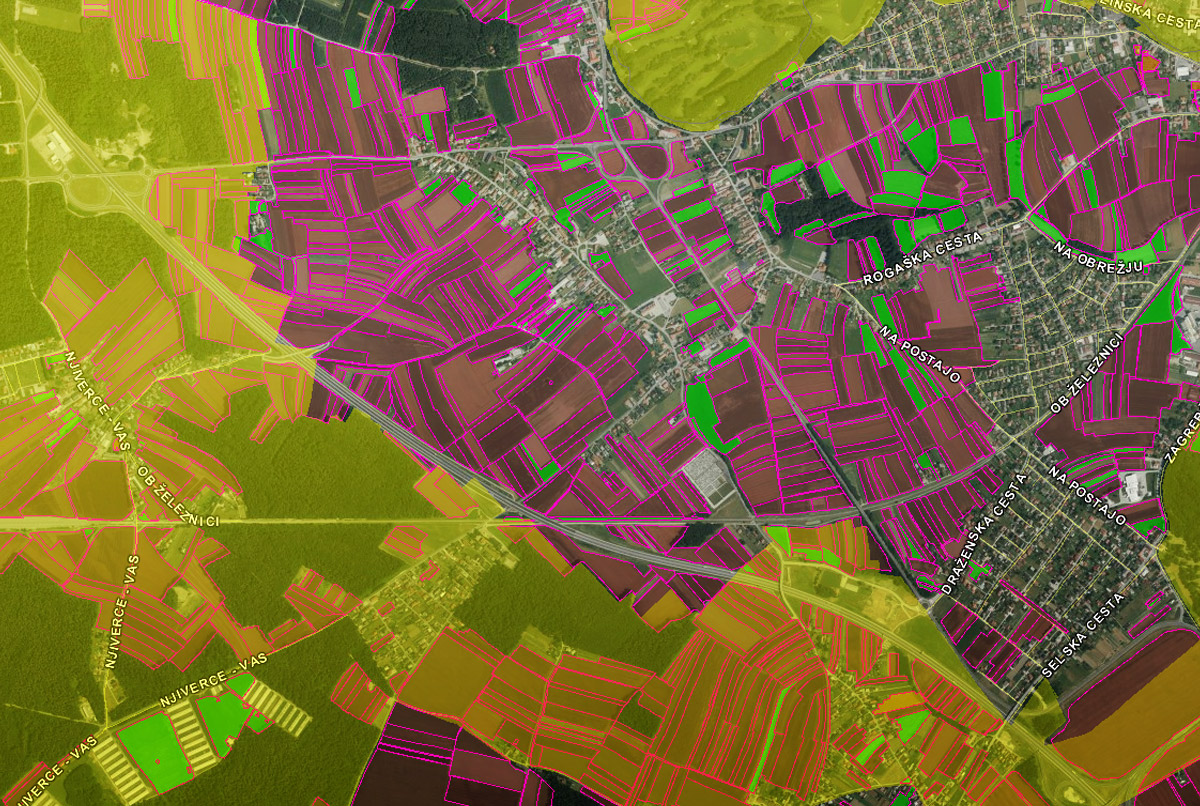
A land-parcel identification system (LPIS) is a system to identify land use for a given country.
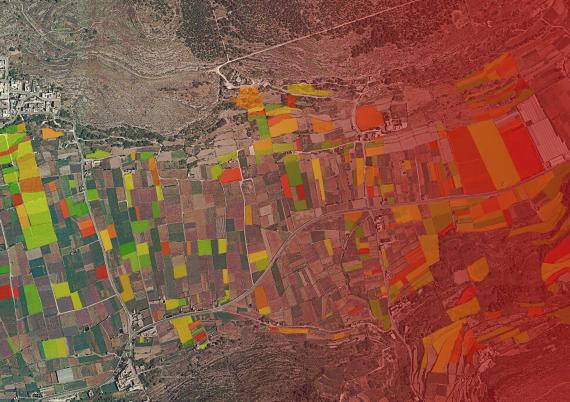
It utilises 'orthophotos' – which include aerial photographs and high precision satellite images that are digitally rendered to extract as much meaningful spatial information as possible.
A unique number is given to each land parcel to provide a unique identification in space and time.
The system is a key control mechanism under the Common Agricultural Policy designed to verify eligibility for area-based subsidies, which amounted to approximately €45.5 billion in 2015.
The auditors concluded that although the LPISs are useful for determining the eligibility of agricultural land, their management could be further improved.
'Weaknesses in the systems'
“Weaknesses in the systems are affecting Member States’ ability to check the eligibility of land," said Mr Nikolaos Milionis, a Member of the European Court of Auditors responsible for the report.
"Reliable data is essential to ensure payments are legal and regular."
While aerial and satellite photographs were mostly up-to-date, their interpretation was not always reliable or conclusive.
Only in some LPISs was additional information concerning ownership and lease rights included in order to ensure that each parcel had been declared by the right farmer.
Member States did not analyse the cost-effectiveness of their systems in order to design checks better.
While Member States had made progress in upgrading their LPISs to meet the requirements of the 2014-2020 Common Agricultural Policy (CAP), the systems had not yet been fully adapted for greening.
Some of the Commission’s efforts to simplify the LPIS rules produced mixed results, say the auditors.