With the tail of Hurricane Ophelia heading for the UK, NFU Mutual has highlighted the devastation flooding can bring.
Rural insurer NFU Mutual has used the example of the devastation caused by the Great Storm of October 1987 to warn homeowners to prepare for autumn gales and floods.
The October 15 1987 storm which devastated the south of England was, at the time, the worst since 1703 and led to over 13,000 claims to NFU Mutual.
With the tail-end of Hurricane Ophelia due to arrive in the UK, NFU Mutual is advising homeowners and businesses to ensure they are ready for autumn storm.
“Checking properties for things like loose roof tiles and gutters can prevent storms causing damage. Inside it’s well worth having torches and emergency supplies on hand in case power goes off,” said NFU Mutual’s Tim Price.
In the Great Storm thirty years ago, this meant that despite roads being blocked by fallen trees and ‘phone lines brought down, NFU Mutual’s local agents were able to get through to affected policyholders to get emergency repairs started.
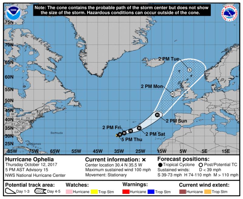
Hurricane Ophelia
Hurricane Ophelia, which developed southwest of the Azores, has reached Category 2 status. When it turns north-east across the North Atlantic, Ophelia will lose energy as she passes over cooler waters.
Before reaching the British Isles the system will lose its tropical characteristics and will no longer be classified as a hurricane.
However, it will still have sufficient energy to produce impacts, such as very strong winds and heavy seas, leading to potentially dangerous waves on exposed locations.
Met Office chief forecaster Steve Ramsdale said: “Understandably, there is a lot of public concern about the potential impacts of ex-Ophilia. In readiness, we have already issued Yellow wind warnings for Northern Ireland and parts of western and northern Britain for Monday and Tuesday, suggesting wind gusts possibly reaching up to 80mph in places.
“Although parts of the UK may experience severe conditions, it’s important to realise that not all areas will be affected by this ex-hurricane. For example, much of eastern England will be unusually warm for the time of year but quite breezy on Monday and Tuesday.”