


Farmers key to bringing back South Downs meadows after decline
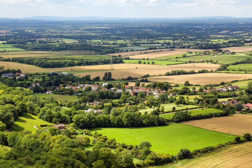
Farmers are set to play a leading role in restoring the South Downs’ lost meadows, as new research reveals that centuries of change have seen almost all of the region’s traditional grasslands disappear.
A study by the University of Portsmouth found that meadowland in the lower Rother catchment of West Sussex has declined by up to 99.9% since the mid-19th century.
By comparing digitised Victorian tithe maps from around 1840 with modern land cover data from 2021, researchers traced how farming practices, land ownership, and environmental policies have shaped — and could now help restore — one of England’s most iconic rural landscapes.
The analysis shows just how profoundly the countryside has changed. Meadows have declined by between 75.6% and 99.9%, marking the steepest loss of any land type.
Unimproved grassland, once rich in wildflowers and biodiversity, has decreased by 86.5%. Arable land has reduced by 45.5%, while improved grassland — used for more intensive grazing — has increased by 135.8%.
Woodland has expanded by 56.3%, reflecting gradual reforestation. Although the total area of common land has barely changed, falling by just 1.7%, its use has shifted away from shared grazing and towards recreation.
Dr Cat Hudson, from the university, said the findings underline the extent of long-term agricultural change. “Our findings show just how much the English countryside has changed since the 1840s.
"Meadows, once vital for haymaking, grazing and wildlife, have almost vanished. Understanding this transformation is essential if we want to restore biodiversity and build more sustainable landscapes.”
The study highlights how enclosure, agricultural intensification, and later government subsidy schemes gradually replaced communal meadows with private, more intensively managed farmland. These developments improved food production and rural livelihoods but also altered natural habitats.
Dr Hudson noted: “The landscapes we see today are the product of centuries of adaptation. But the historical record shows that past changes often came at the cost of natural resilience.
"Using tithe maps helps us understand how to balance productivity, conservation, and heritage in the face of climate change.”
The researchers emphasise that today’s farmers and land managers will play a vital role in restoring meadow habitats and strengthening the landscape’s resilience.
Collaborative approaches — combining traditional knowledge with modern sustainability practices — are seen as key to achieving both environmental and economic goals.
Dr Harold Lovell, also from the university, explained: “Historical records offer a powerful tool for identifying where restoration could have the greatest impact.
"By recognising the cultural and environmental significance of features like meadows, hedgerows and field boundaries, we can encourage interventions that protect both the landscape’s heritage and its future ecological health.”
The research supports the UK government’s 25 Year Environment Plan, which calls for restoring semi-natural grasslands, conserving ancient woodland, and protecting rural heritage features.
The findings will help local authorities such as Natural England and the South Downs National Park Authority integrate cultural history with modern environmental ambition.
Dr Lovell concluded: “By linking the past to the present, we can make better decisions about the future of our countryside. Historical evidence like this can guide us toward farming systems that are productive, resilient, and rooted in the landscapes that shaped them. Farmers are key partners in that journey.”


