


New national peat map to shape environmental and agricultural policies
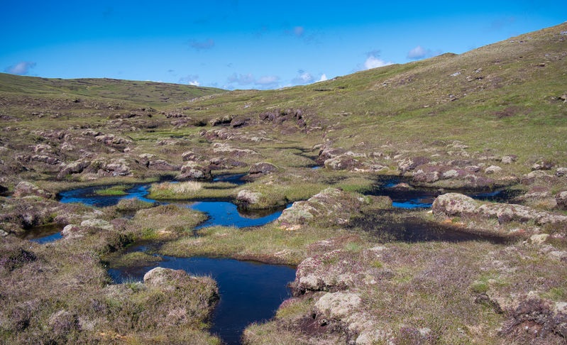
Natural England has unveiled a long-anticipated update to the mapping of England’s peatlands, offering a significantly enhanced picture of the location, depth, and condition of peaty soils across the country.
The England Peat Map (EPM), commissioned by Defra and delivered by Natural England, is expected to play a key role in guiding future environmental and agricultural decision-making.
It is set to influence Local Nature Recovery Strategies, emissions monitoring, land use planning, and land management schemes.
Available on Defra’s ArcGIS portal, the map forms a national dataset that replaces older, less detailed maps such as the 2008 ‘peaty soils location’ and earlier datasets based on 1980s core sampling.
“This new mapping marks an important step in building a more detailed and evidence-based understanding of England’s peatlands,” said NFU deputy president, David Exwood.
The map uses a combination of extensive historic data, new field surveys, satellite imagery, and machine learning to model peat soils with unprecedented resolution.
Peatlands are vital for carbon storage and water regulation, but many are also essential to agricultural production, particularly in lowland regions where peaty soils support intensive horticulture and arable farming.
While the map itself does not change land use rights, it is expected to inform future policy and environmental regulation.
Responding to the announcement, Mr Exwood stressed the importance of balancing environmental goals with food production.
“This data must now be used to inform practical and proportionate policies that recognise both the environmental importance of peat and the need to maintain food production in some of our most fertile and iconic landscapes.
"Farmers are already working hard to protect soil health and reduce emissions, but to secure long-term improvements, peatland restoration efforts must be flexible, locally tailored and support the viability of farm businesses.
“We have also seen a huge number of wildfires on upland peatlands. It’s important Defra works with farmers to control vegetation load and make sure wildfire doesn’t further damage peat.”
The NFU is seeking input from farmers to determine how accurately the new map reflects conditions on the ground.
Farmers who work on or near peatland are being encouraged to share feedback by emailing nfuenvironment@nfu.org.uk.


