


Soil map uses gamma-ray detection tech to offer greater accuracy
A soil mapping service which uses gamma-ray detection technology has been launched for farmers looking for more accuracy in understanding their soils.
Today’s precision farming requirements demand increasing accuracy to allow farmers to work more efficiently.
Looking to achieve this, TerraMap, launched by crop production specialists Hutchinsons, revolutionises the way in which soil nutrient mapping is currently undertaken in the UK.
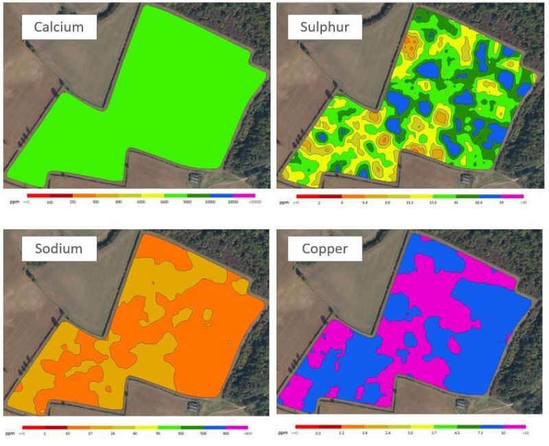
The map uses gamma-ray detection technology that delivers resolutions of over 800 points/ha.
It provides high definition mapping of all common nutrient properties, pH, soil texture, organic matter and CEC as well as elevation and plant available water.
Hutchinsons precision technology manager, Oliver Wood said such technology 'has not previously been possible'.
“With such a growing level of interest in soils, the launch of TerraMap comes at the perfect timing for farmers that are looking for that next level of accuracy in understanding their soils - which has not previously been possible.
“We have been looking for a new method of mapping soils that provides more accurate and repeatable results, and can also leverage the multi-layer analysis within Omnia,” Mr Wood said.
The results from TerraMap are used to create maps within the Hutchinsons Omnia system which can then be overlaid with additional field information such as black-grass, yields and so on, to create the most accurate variable rate plans.
The infield process of collecting the data is carried out in two steps; scanning by driving a light weight all terrain vehicle fitted with the sensor over a field, and then taking soil samples to allow for each scan to be used to create the individual map layers.
Manufactured by Canadian company SoilOptix, TerraMap’s scanning technology is based on a scaled-down version of airborne sensors that originates in mineral prospecting, and has been used in other countries successfully.
It measures naturally emitted isotopes, like Caesium and Potassium, that are very stable due to their long half-lives.


