


Start-up's free promo for farmers aims to help them comply with soil rules

Soil Benchmark, an agri-tech start-up, is offering farmers free access to a new feature within its Digital Soil Management Platform, but only for a limited time.
The new module automatically generates maps which can help farmers comply with Nitrogen Vulnerable Zone (NVZ) rules and the Farming Rules for Water (FRfW).
The platform offers farmers tailored Soil Management Plans, providing insights and compliance with the SAM1 action of Defra's Sustainable Farming Incentive (SFI) scheme.
Since its launch last November, Soil Benchmark, a Yorkshire-based start-up, is used by over 700 farms, spanning more than 200,000ha.
To commemorate this milestone, the tech company has announced a promotion on the platform’s latest feature.
Between 8 March and 15 March, farmers and agronomists can get free access to the new Manure Spreading Map feature within Soil Benchmark.
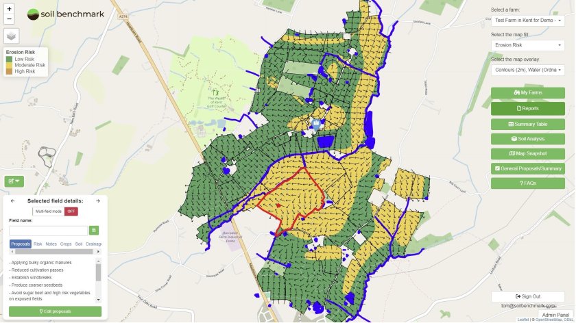
This typically costs £0.80/ha/year to farms subscribed to the ‘Soil Sage’ package, which costs about £200/farm/year.
The Soil Sage package unlocks field-by-field Soil Management Plans for any sized farm.
When combined with a Manure Spreading Map, it helps farms comply with NVZ rules, Farming Rules for Water, and the SAM1 action of SFI23.
Tom Scrope, co-founder and CEO, said he was proud to have reached this significant milestone of surpassing 200,000ha of land since its launch four months ago.
“This represents more than 2% of England’s agricultural land and to celebrate this, we are excited to offer this promotional period for our platform.”
Dr Ben Butler, co-founder, added that Soil Benchmark’s mission was to improve soil health at scale, and allow farmers to easily define risks to soils using trusted data sources.
“As such, our platform pre-populates Soil Management Plans and Manure Spreading Maps with data derived from trusted sources, including the Environment Agency, Ordnance Survey, and British Geological Survey.
“The user is then free to fine-tune each field using their expertise and local knowledge, creating maps and plans that clearly and accurately define where risks are, and ultimately having impact on the ground."


