


Natural methods could help farmers stop rivers bursting banks miles downstream
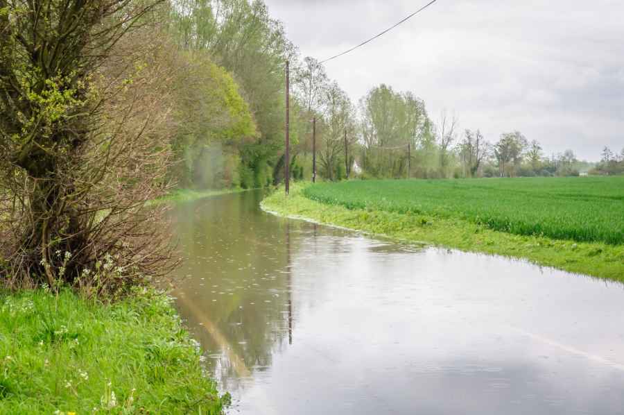
Choosing different crops, building soil organic matter and planting more trees could allow farmers to reduce the risk of nearby rivers from bursting their banks miles downstream.
According to a new research project by the University of Reading, these measures could help stop farmers from being flooded.
The project will work with farmers across the West Thames area to learn how different land management methods impact on flood risk.
The LANDWISE (LAND management in loWland catchments for Integrated flood riSk rEduction) proposal will receive £1.25m from the Natural Environmental Research Council (NERC).
The research explains that a lot of attention has been given to ‘slowing the flow’ within river channels using wood to create leaky barriers.
LANDWISE aims to look at the wider landscape and investigate ways to reduce the volume of water entering river channels in the first place, and to ‘slow the flow’ by enabling water to move slowly below the ground surface.
It says this can be done by increasing the amount of water that can be absorbed by soil and returned to atmosphere through crops and trees, or stored in deep groundwater.
'Natural methods'
These more "natural methods", as the project describes, include crop choice, land preparation, building soil organic matter and tree-planting.
The measures can reduce the amount of water that runs off the land surface. They improve soil structure to allow more rainwater to infiltrate below ground, according to the researchers.
Dr Joanna Clark, project leader said: “If you think about the land surface as a bucket, then these different land use and management methods can help us to increase the size of that bucket and help to empty it so that it can hold more water when it rains again.
“This is about making small changes over the large catchment area as a whole, rather than large changes in small areas where flooding occurs.
“We found there are many farmers who have already made responsible changes to their land management practices that have the potential to reduce flooding, and others could be further incentivised by changes in agricultural policy.
Dr Clark continued: “More work is now needed to fully understand how effective current efforts made by farmers to rebuild soils have been to reduce flooding - the LANDWISE project will quantify by how much, where and how the flood risk benefits are scaled up from small catchment to large river basins, like West Thames.
“To do this, we will work on developing methods to measure the land surface from space and use of this data in predictive models alongside local knowledge.”
West Thames River Basin
The LANDWISE research focuses on the West Thames River Basin area, where around 112,000 properties are thought to be at risk of flooding if rivers burst their banks, almost 10,000 are at risk of groundwater flooding, and many more are in danger of surface water flooding.
Work will initially focus on the Loddon, Pang and Upper Thames catchments, before being scaled up to the Thames river basin upstream from Oxford and Maidenhead.
The project will explore whether broad scale changes in land use and management could have helped to reduce the severity of flooding events of July 2007 and winter 2013/14.
The team will aim to influence future Government policy on land use and management changes after Britain leaves the EU.


